
-
×
 Edge 530 Gps Bundle,Topoactive Africa
1 × KSh 53,125.00
Edge 530 Gps Bundle,Topoactive Africa
1 × KSh 53,125.00
Subtotal: KSh 53,125.00
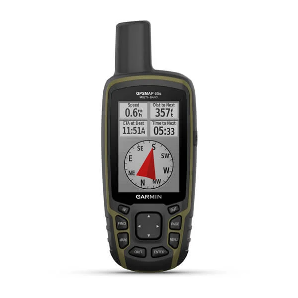
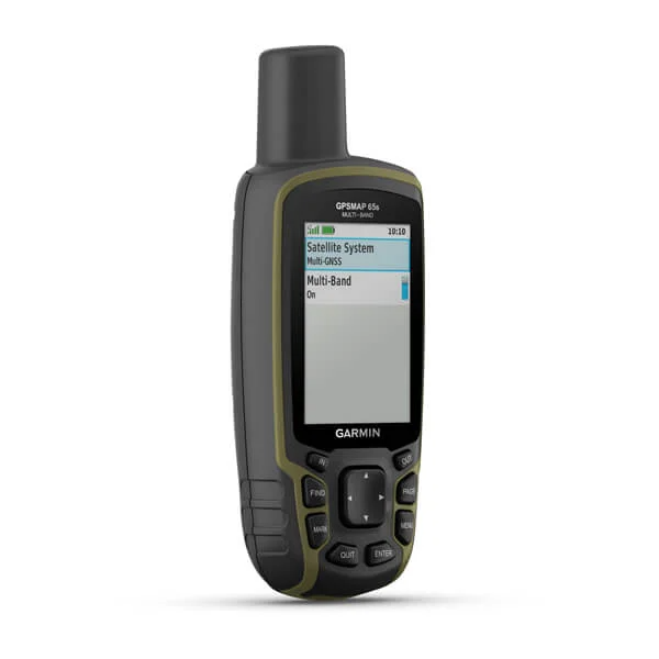
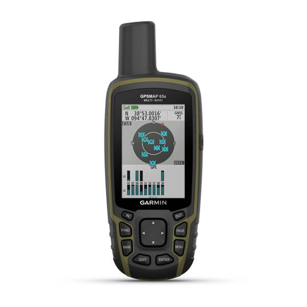
Multi-Band GNSS Support: Enhanced accuracy with GPS, GLONASS, Galileo, QZSS, and IRNSS.
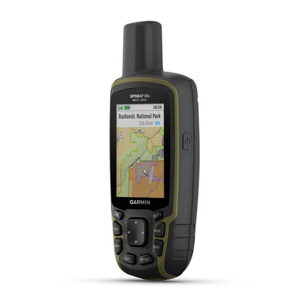
Preloaded TopoActive Africa Maps: Detailed terrain and route information across the continent.
2.6″ Sunlight-Readable Display: Clear visibility in various lighting conditions.
ABC Sensors: Built-in altimeter, barometer, and 3-axis electronic compass.
16-Hour Battery Life: Operates on 2 AA batteries (NiMH or Lithium recommended).
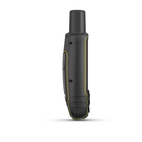
Rugged Design: IPX7 water rating and MIL-STD-810G compliance.
Smart Notifications: Receive emails, texts, and alerts when paired with a compatible device.
Garmin Explore™ Compatibility: Plan, review, and sync waypoints, routes, and tracks
KSh 65,000.00
Model: Garmin GPSMAP 65S
Part Number: 010-02451-12
Dimensions: 6.1 x 16.0 x 3.6 cm
Weight: 217 g (with batteries)
Water Rating: IPX7 (waterproof up to 1 meter for 30 minutes)
Operating Temperature Range: -20°C to 60°C
Storage Temperature Range: -40°C to 70°C
Size: 2.6″ diagonal
Resolution: 160 x 240 pixels
Type: Transflective, 65K color TFT
Type: 2 AA batteries (NiMH or Lithium recommended)
Battery Life: Up to 16 hours
Internal Memory: 16 GB (user space varies based on included mapping)
MicroSD™ Slot: Supports up to 32 GB microSD™ card
Supported Systems: GPS, GLONASS, Galileo, QZSS, and IRNSS
Multi-Band Frequency Support: Enhanced accuracy in challenging environments
ABC Sensors:
Altimeter: Provides elevation data
Barometer: Monitors weather changes
3-Axis Electronic Compass: Offers accurate heading information
Wireless Connectivity: Bluetooth® and ANT+®
Smart Notifications: Receive emails, texts, and alerts when paired with a compatible device
Garmin Explore™ Compatibility: Plan, review, and sync waypoints, routes, and tracks
Preloaded Maps: TopoActive Africa maps
Geocaching: Paperless geocaching with automatic cache updates from Geocaching Live
Route Planning: Supports up to 200 routes, 250 points per route
Track Log: 10,000 points, 200 saved tracks
Waypoints/Favorites/Locations: 5,000
Hunt/Fish Calendar: Provides optimal times for hunting and fishing
Sun and Moon Information: Displays sunrise and sunset times
Area Calculation: Measures areas
Picture Viewer: View images
Display: 1.2″ AMOLED touchscreen with 390 x 390 resolution
Battery Life: Up to 11 days in smartwatch mode; up to 21 hours in GPS mode
Build: 42.2mm fiber-reinforced polymer case; silicone strap
Connectivity: Bluetooth, Wi-Fi, ANT+
Sensors: GPS, GLONASS, Galileo; wrist-based heart rate monitor; Pulse Ox; accelerometer; compass
Health Monitoring: Sleep tracking, stress monitoring, Body Battery™, advanced sleep insights
Smart Features: Smart notifications, music storage, Garmin Pay™ contactless payments
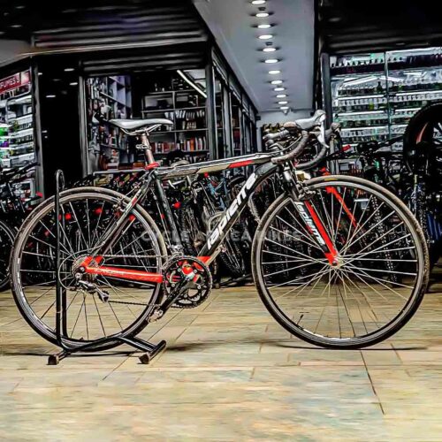
Frame and Fork: Constructed with a lightweight Cruztrek alloy road frame paired with a Cruztrek carbon fork, ensuring a responsive and smooth ride.
Drivetrain: Equipped with a Shimano Sora 2×9-speed drivetrain, offering precise and reliable shifting across various terrains.
Braking System: Features alloy flat mount disc brakes that provide consistent and powerful stopping power in diverse weather conditions.
Wheels and Tires: Rides on 700C double-wall alloy rims fitted with CST 700C x 28C tires, balancing speed and traction for road cycling.
Design: Showcases a sleek cyan and silver color scheme, combining aesthetic appeal with functional design.
Lapierre were launched in 1946 by Gaston Lapierre in Dijon, France. In 1960, Gaston’s son, Jacky took the helm and constructed a new factory in 1972 before passing responsibility to his son, Gilles in 1996. From there on the company grew with their innovative ideas, and decision to continue bike assembly at their headquarters in Dijon.
Components
Select at least 2 products
to compare


There are no reviews yet.